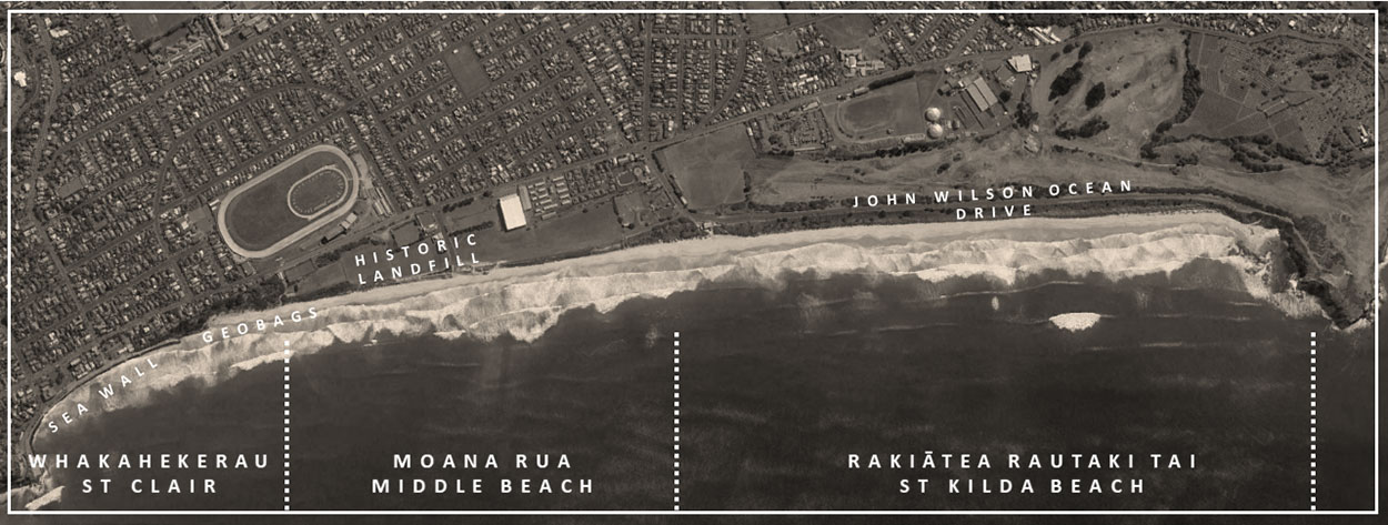
An important part of South Dunedin’s future will be managing the impact of climate change on the coast. The St Clair – St Kilda Coastal Plan is one of the related projects that will contribute to the wider programme.
The St Clair – St Kilda Coastal Plan was adopted by Council at its meeting on 22 February 2022. This means that there is now a plan to inform how this coast is managed and how it will need to adapt, in time, to the effects of coastal hazards and climate change.
A range of work will begin over the coming months and years and will involve further investigation, planning and physical works. This will include things like an investigation of the Kettle Park landfill, implementation of a comprehensive monitoring programme for the coast and improvements to beach access at St Clair. Please refer to the St Clair – St Kilda Coastal Plan (Site-Specific Plans section) to learn more about the proposed short-term actions.
As key items of work progress (such as the Kettle Park landfill investigation), updates will be provided and the implications for management will be communicated to stakeholders and the community.
The adoption of the St Clair – St Kilda Coastal Plan represents the significant change in the management of this valued coast. Thank you to everyone involved in developing the plan over the last two and a half years.
-
Our engagement so far
Development of the plan involves a multi-phase engagement process – the first part of which was understanding “what matters most” to people about the coast. Finding out what the community truly values about the area helps us identify options that, over time, solve multiple issues, build resilience, and create new opportunities for recreation and environmental benefits along this coast. Feedback on this first phase closed ran from February to August 2020.
From September to December 2020, a second round of conversations involved working closely with the community and stakeholders through a series of workshops and online to prioritise the values received from the first round of engagement. We also partnered with local artists and hosted two printmaking sessions where people expressed their vision for the coast.
Using an understanding of what the community values for the coast and technical support, we produced a set of concept visuals on what this area could like for the future. From February to March 2021, we hosted a third round of conversations to discuss with the community and stakeholders their views on the ideas.
-
Coastal plan survey full map
St Clair - St Kilda beach drone images
You might have noticed a drone flying over the beach before and after storms. This drone captures images allowing us to monitor the shape of the beach and the impact of storms. Identifying erosion hotspots helps us develop the most suitable engineering option in the frame of the Coastal Plan. You can access the data via these St Clair - St Kilda drone images.

