Improving the Harbour Arterial – Caversham Motorway (SH1)/Andersons Bay Road intersection, Andersons Bay Road, Strathallan Street, Wharf, Thomas Burns and Ward Streets, and the Ward Street overbridge – will provide a safe and efficient route connecting SH1 and SH88, be an alternative route for traffic which wishes to bypass the central city and be a route to divert heavy vehicles from the city centre.
Stages 2 and 3 of the project are now underway, following the completion of Stage 1 (Wharf Street and surrounding intersections).
Stage 2
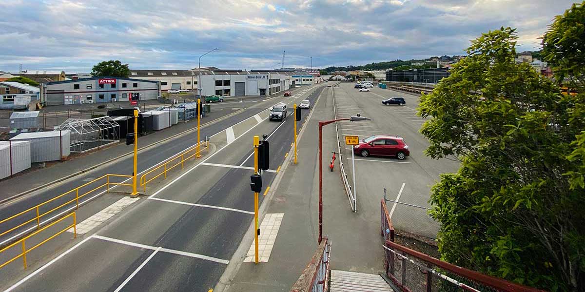
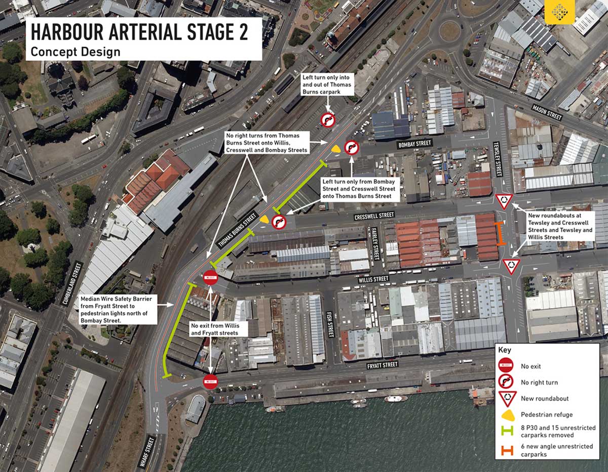
A median wire safety barrier will be constructed on Thomas Burns Street from Fryatt Street to the pedestrian crossing signals (north of Bombay Street). The barrier will prevent vehicles turning right from Thomas Burns Street into Willis, Cresswell and Bombay Streets.
Vehicles turning out of Cresswell and Bombay Streets will only be able to turn left onto Thomas Burns Street.
We are proposing that vehicles will be unable to exit from Willis Street and Fryatt Street onto Thomas Burns Street. Only vehicles travelling south on Thomas Burns Street will be able to turn left into these streets.
Feedback from businesses in the area to date indicate that there is a desire to keep Fryatt Street a two-way street with the ability to turn left onto Wharf Street. We are looking into this alternate proposal and to do this safely, the current speed limit of 60km/h will need to be reduced to 50km/h and we will also need to change the way the left lane joins Wharf Street.
We are also proposing to construct two roundabouts at the intersections of Tewsley/Willis Streets and Tewsley/Cresswell Streets to assist with circulation within the industrial area.
Carparking
Six new parallel unrestricted carparks will be installed on Tewsley Street and 15 carparks (5 x P30 and 10 x Unrestricted) will be removed from Thomas Burns Street because the live southbound lane will need to move closer to the kerb.
Vehicles can only turn left into and out of the Thomas Burns Street carpark.

Concept design
Please see below the concept design for Thomas Burns Street and surrounding streets, including the median wire safety barrier, intersection changes, new roundabouts and carparking changes.

Stage 3
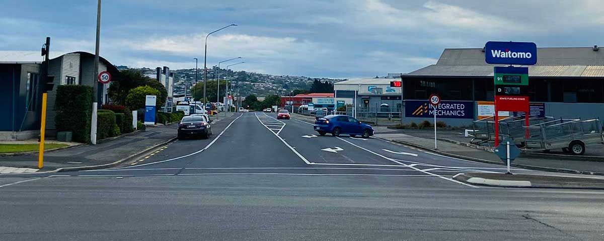
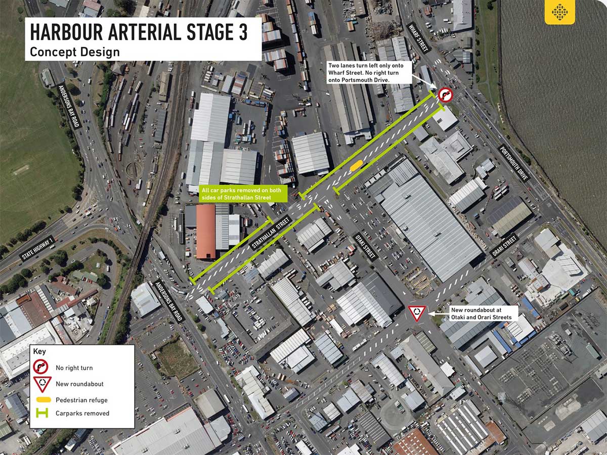
At the eastern end of Strathallan Street, vehicles will be required to turn left only onto Wharf Street. Currently there are two left-hand lanes – one turns left and one turns right onto Portsmouth Drive. The right-turning lane will be changed to a left-turning lane and the junction reset.
All carparking will be removed from both sides of Strathallan Street and a pedestrian ‘refuge’ will be installed near the intersection of Strathallan and Otaki Streets.
A new roundabout is being constructed at Otaki and Orari Streets to assist with traffic circulation and improve access to Orari Street – where traffic will still be able to turn right onto Portsmouth Drive.

Concept design
Please see below the concept design for Strathallan, Portsmouth Drive/Wharf Street, and Orari and Otaki Streets.

Feedback
Consultation has now closed and we are reviewing the feedback we have received. The next phase of this project will be finalising plans for both the Thomas Burns section and the Strathallan Street section of the Harbour Arterial route.
Frequently asked questions
-
Where is Dunedin’s Harbour Arterial route?
The Harbour Arterial route uses these roads (south to north): Caversham Motorway (SH1)/Andersons Bay Road intersection – Andersons Bay Road – Strathallan Street – Wharf Street – Thomas Burns Street – Ward Street – Ward Street overbridge.
When finished in 2027, the Harbour Arterial will run along Frederick, Ward, Thomas Burns and Wharf Streets connecting to SH88 and SH1 using Ward Street and the Ward Street overbridge to the Frederick Street/Anzac Avenue intersection. St Andrew Street will still be available.
-
How many vehicles travel on the route each day?
The Harbour Arterial is already a busy route, carrying around 16,600 vehicles per day.
-
How will work on the Harbour Arterial route be carried out?
From 2021 to 2027, the work on the Harbour Arterial improvements will be carried out in four stages starting with the less complex works.Stage 1 has now been completed and the remaining stages are:
Stage 2: Road and minor intersection improvements on Thomas Burns Street from Fryatt Street to the pedestrian crossing signals (north of Bombay Street). Construction is expected to start in 2023.
Stage 3: Road improvements and intersection upgrades on Strathallan Street, Wharf Street, Portsmouth Drive and Otaki and Orari Streets. Construction is expected to start in 2023.
Stage 4: Road improvements and intersection upgrades from the Railway Station footbridge to Frederick Street/Anzac Avenue SH88 via Ward Street and the Ward Street railway overbridge.
-
What is the project scope?
The scope of the project includes:
- Direction signs and real time information showing congestion/delays on SH1 and the current Harbour Arterial route
- Major and minor intersection upgrades to address known safety and efficiency issues
- Road improvements
- Upgrade to the Ward Street overbridge
- Minor improvements for pedestrians and cyclists
-
How much will the project cost?
The Harbour Arterial improvements project is estimated to cost $16.3 million and is partly funded by Waka Kotahi NZ Transport Agency.
-
What will the project bring to the city?
- An improved alternative route for freight/traffic bypassing the central city, the Hospital site and the rail level crossing, resulting in more efficient and reliable travel times
- Reduces/ avoids disruption during construction of the new Dunedin Hospital, which is expected to affect traffic on SH1 in the central city
- A connection to the shared pedestrian/cycling path around the Otago Harbour, from Port Chalmers to the Otago Peninsula.
-
What other transport projects are underway or about to begin?
Seven major projects have been developed to ensure that transport disruption is minimised during and after the construction of the new Dunedin Hospital. One of them is the Harbour Arterial project.
The other six are:
- Princes Street Connections project
- Mosgiel Park and Ride - providing parking at Mosgiel so commuters can take an express bus into the city
- Central City Parking Management - providing ways to help motorists find parking places and improve technology to make it easier to manage parking
- Central City Bike Hubs – installing hubs in central city locations where bikes can be securely stored
- Central City Cycle And Pedestrian Improvements – filling gaps in the central cycle network and linking the harbour to the city centre
- Travel Demand Management – working with the city’s major employers to help manage travel and disruption
