Safer Streets is a project to improve the road safety of Dunedin’s busiest streets. It also aims to make streets easier for people to use, however they chose to travel.
The project seeks to:
- Improve road safety for all users, including motorists, cyclists, pedestrians and people using buses
- Make it easier to get to bus stops, local shops and schools
- Create streets that are easy to understand with consistent design features for busy roads across Dunedin
Among other criteria, we have chosen these streets/roads first because there is a lot of room to make improvements for everyone without causing too much disruption or change for others.
-
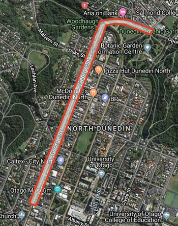
Bank Street and George Street
-
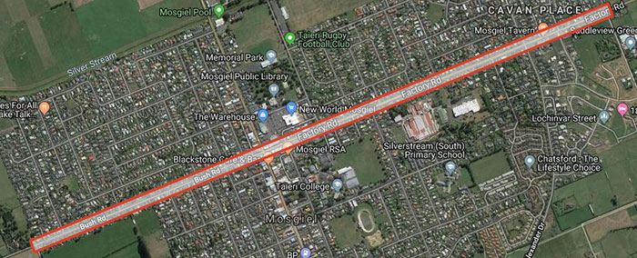
Factory Road and Bush Road
-
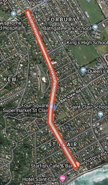
Forbury Road
-
Main Road, Fairfield and Main South Road

-
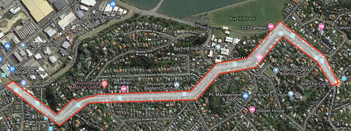
Musselburgh Rise and Silverton Street
-
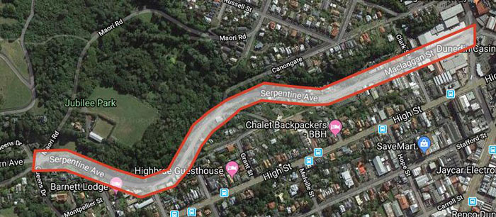
Serpentine Avenue and Maclaggan Street
-
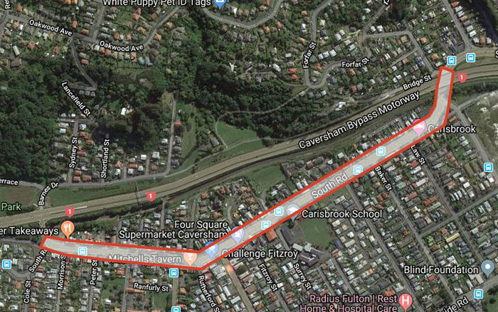
South Road
Latest developments
Two routes, South Road and Factory/Bush Roads, will be developed to ensure the Tunnels Trail connects the Dunedin CBD to Mosgiel. We are proposing to have cycle lanes on these roads and will consult on this within the next year:
- Between Barnes Drive and Glen Road
- Factory and Bush Roads between Wingatui Road and Berwick Street
These cycleways are estimated to cost $2.6m and $3.4m respectively.
What are examples of street/road improvements that can come from this project?
Outcomes depend on consultation, but these are examples of potential improvements:
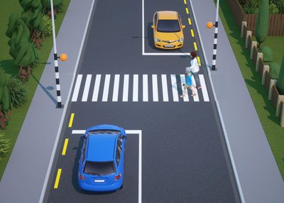
- More crossing points to make it safer for people to cross the road, especially near bus stops, shops or schools. A crossing point is a safe place to cross the road, but not always a pedestrian crossing.
- Clear lane markings to make it safer for cyclists and motorists to share the streets.
- Lower speed zones around schools and commercial centres.
- Removal of painted flush median to slow down traffic and make space for cyclists. Flush medians are white diagonal lines, painted down the centre of a street
- More drop kerbs to make it easier for those on wheels to cross the road. A drop kerb is a small ramp build into the kerb of a footpath to make it easier for people using pushchairs or wheelchairs to pass from the footpath to the road
- Better visibility at intersections and crossing points.
- Bus super stops in North East Valley and South Dunedin.
Frequently asked questions
Is this connected to other projects?
The Safer Streets project is part of the Dunedin Urban Cycleways Programme which also includes the Peninsula Connection project.
It also links with the Tunnels Trail project, a 15km long track, beginning on Factory Road, following the rail line past the Wingatui racecourse using an existing track and enters the Chain Hill Tunnel off Gladstone Road North. The trail exits the Caversham Tunnel onto an existing shared path on Barnes Drive that links to South Road. This project is expected to start in 2023.
What is the cost of the project and how is it going to be funded?
The total cost of the project is estimated to be $18.3m. This will be co-funded with Waka Kotahi NZ Transport Agency. Each project has an individual budget:
- Bank Street and George Street: $2.8m
- Main Road and Main South Road: $3.3m
- Musselburgh Rise and Silverton Street: $2.4m
- South Road: $2.6m
- Serpentine Avenue and Maclaggan Street: $2m
- Forbury Road: $1.8m
- Factory Road and Bush Road: $3.4m
Will this project help reduce carbon emissions?
Yes. This project supports the Council’s Carbon Zero By 2030 goal, and the 40% active mode (walking, cycling and public transport) share goal that was agreed in the Integrated Transport Strategy by 2024.
